Sentinel-3C Satellite Returns First Color Images of Earth
At a Glance
- Europe’s Sentinel-3C satellite has captured its first images of Earth.
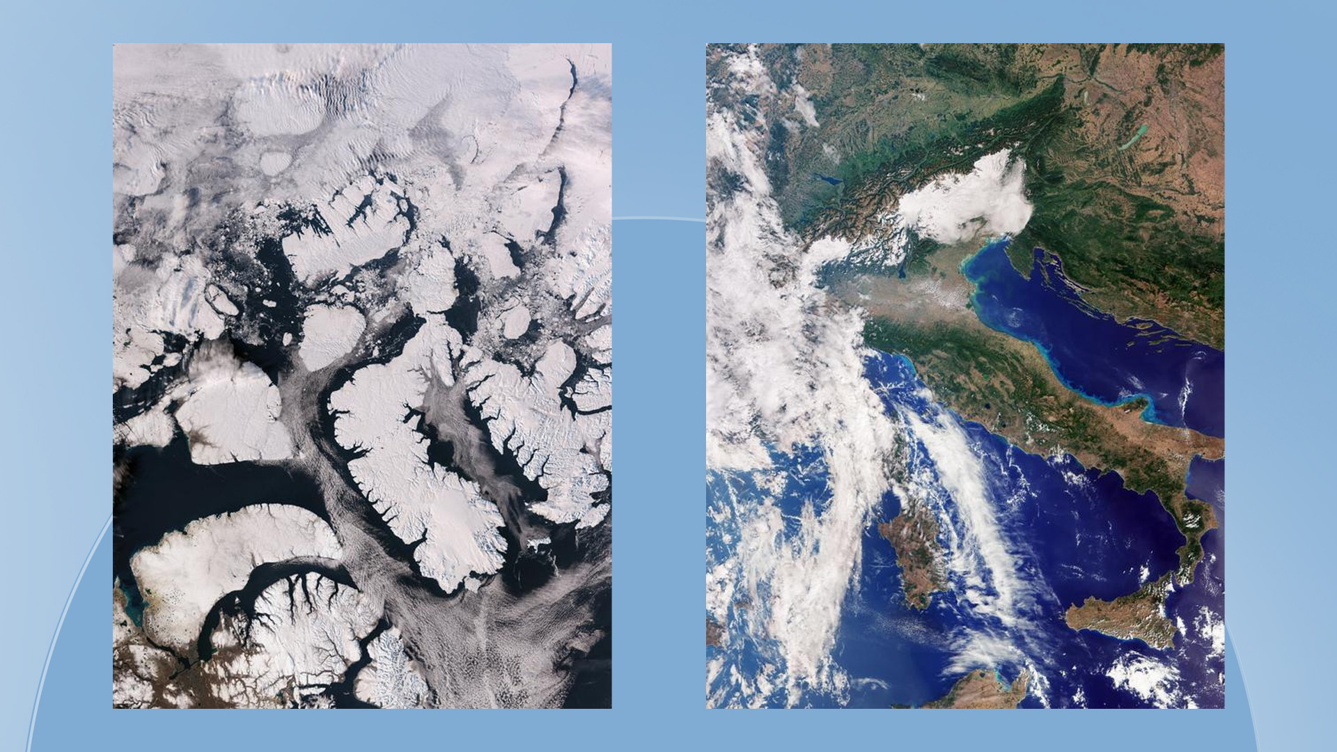
- Initial views show Italy and the Canadian Arctic in natural color.
- The satellite will monitor oceans, land, sea ice, and polar ice sheets.
- The European Space Agency expects commissioning to take another five months.
The European Space Agency’s Sentinel-3C satellite has returned its first images of Earth just two weeks after launching, capturing detailed views of Italy and the Canadian Arctic. The satellite will expand a long-term monitoring mission that provides data on oceans, land, ice, and atmospheric conditions to support environmental research and monitoring.
Key Statements and Focus Area
- First images: The satellite’s ocean and land color instrument captured natural-color views of Italy and the Canadian Arctic.
- Environmental monitoring: The Sentinel-3 mission tracks sea-surface conditions, marine pollution, wildfires, drought, and changes in ice cover.
- Commissioning phase: The European Space Agency says testing and preparation for operational service will continue for about five months.
First views from orbit
The first images from Sentinel-3C include a detailed view of Italy, extending from southern Germany to Sicily and the southern Mediterranean.
Another image, captured on September 30, shows part of the Canadian Arctic Archipelago west of Greenland. Snow-covered islands, rugged coastlines, deep fjords, and exposed rock form patterns across the landscape.
Although sea ice is near its annual minimum at this time of year, the image also shows fractured ice floes scattered across dark open water. In addition to the color images, the satellite’s synthetic aperture radar altimeter has returned measurements of the Greenland ice sheet’s height and the sea surface.
Monitoring Earth's changing environment
Sentinel-3C is the third satellite in the European Space Agency’s Sentinel-3 series. It carries the same suite of instruments as the other satellites in the mission, designed to systematically observe the oceans, land, cryosphere, and atmosphere.
Over the oceans, the satellites measure sea-surface temperature, color, and height, as well as sea-ice thickness. These observations help researchers monitor marine pollution, marine heatwaves, and changing ocean conditions.
Over land, the mission provides data used to track drought and wildfires, map land use, assess vegetation health, and measure the height of rivers, lakes, and polar ice sheets.
Five months of testing ahead
The European Space Agency is still commissioning Sentinel-3C before it enters operational service. The process involves testing and validating its systems and instruments and is expected to take another five months.
The satellite’s early images and measurements provide an initial indication of its capabilities, while further work remains before the mission becomes fully operational.
FYI
The Copernicus program is the European Union’s Earth observation program, providing environmental information using satellites and other sources of data. Its observations support applications ranging from climate research and disaster response to ocean monitoring and land management.
The Sentinel-3 mission is designed to provide consistent, long-term measurements of Earth’s surface and oceans. Such records help scientists identify environmental changes over time and support decision-making across multiple sectors.
Dive Deeper: Handpicked Stories for You
Follow Channel8 for continuous updates:
2 hours ago